
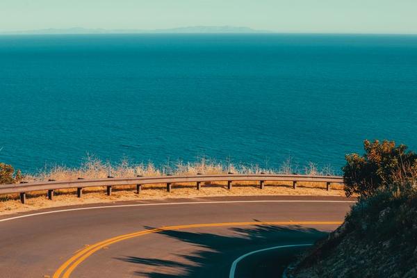
California’s coast is one of those rare road-trip routes where the journey really does matter as much as the destination. A Pacific Coast Highway road trip can move from city skylines and surfing towns to cypress-lined headlands, redwood canyons, sea cliffs, and quiet beaches in the space of a few days. The classic stretch between San Francisco and Los Angeles is the most popular choice, and driving south keeps many ocean viewpoints on the passenger side of the road for easier pull-offs.
Highway 1 California is better planned as a series of short scenic days, especially around Monterey, Big Sur, and Santa Barbara. Five to seven days gives most travelers enough time to stop without turning every viewpoint into a rushed photo break.
How Long Does a Pacific Coast Highway Road Trip Take?
You can drive between San Francisco and Los Angeles in a long day using inland freeways, but that misses the point of a PCH road trip. The coastal route is slower, curvier, and full of worthwhile detours. For a first trip, five days is a practical minimum, while seven days feels much more relaxed.
A simple plan is to spend one night around Monterey or Carmel, one or two nights near Big Sur or San Luis Obispo County, one night in Santa Barbara, and finish in Los Angeles.
Best Direction and Route to Drive
For the classic experience, start in San Francisco and head south toward Los Angeles. This direction puts the Pacific Ocean beside you for much of the route and makes many scenic pullouts easier to access. From San Francisco, follow the coast through Half Moon Bay and Santa Cruz before reaching Monterey and Carmel.
From there, the Big Sur drive becomes the visual centerpiece of the trip. Continue south through dramatic cliff country toward San Simeon, then Morro Bay and San Luis Obispo. Farther south, the road leads through Santa Barbara, Ventura, Malibu, and finally Santa Monica.
Highway 1 is vulnerable to landslides, maintenance work, and temporary traffic controls, particularly around Big Sur. Even when the main route is open, delays can appear with little notice. Check Caltrans QuickMap and current Highway 1 conditions on the morning of each major driving day, especially before committing to the Big Sur section.
Pacific Coast Highway Stops Worth Building Around
Monterey and Carmel
Monterey and Carmel make an ideal first overnight stop. Monterey offers a lively waterfront, while Carmel has a compact village center and a beautiful beach. Nearby Point Lobos State Natural Reserve is one of the best places to slow down before entering Big Sur, with coastal trails and excellent wildlife viewing.
Big Sur
Big Sur is not one single attraction; it is a long stretch of coastline where the road itself is the experience. Bixby Creek Bridge, Garrapata State Park, Pfeiffer Big Sur State Park, and the viewpoints near McWay Falls are among the best-known Pacific Coast Highway stops. Allow extra time because short distances can take much longer once you factor in parking, walking, and traffic.
A useful real-world strategy is to leave Carmel early, make two or three priority stops before lunch, then continue south without trying to stop at every turnout. For example, choose Bixby Creek Bridge, one short coastal hike, and one waterfall or beach viewpoint.
San Simeon, Morro Bay, and San Luis Obispo
South of Big Sur, the coastline opens up around San Simeon. Hearst Castle is the headline attraction, while the Piedras Blancas elephant seal viewing area is an easy and memorable roadside stop. Morro Bay offers a relaxed waterfront, while San Luis Obispo makes a convenient overnight base.
Santa Barbara, Malibu, and Santa Monica
Santa Barbara shifts the mood from rugged coast to palm-lined Mediterranean-style streets. It is a good place for a relaxed evening before the final leg south. From there, continue through Ventura and Malibu, where beaches and ocean views carry you toward Santa Monica.
Best Time to Drive Highway 1
Late spring and early autumn are often the best balance of manageable crowds, comfortable temperatures, and long daylight hours. September and October can be especially appealing because the coast is frequently clearer after the foggier early-summer period. Spring brings greener hillsides and wildflowers, although wet weather can still affect road conditions.
Summer offers the longest days but also the heaviest visitor traffic, especially around Monterey, Big Sur, and popular beaches. Winter can be beautiful and quieter, but storms increase the risk of rockslides, debris, and temporary closures. If your itinerary depends on driving the full coast, build flexibility into winter plans.
How to Plan Each Driving Day
Think in terms of stops rather than mileage. A 100-mile day on Highway 1 can easily fill several hours once scenic overlooks, meals, walks, and parking are included. Avoid booking dinner, tours, or hotel check-ins so tightly that one traffic delay ruins the rest of your schedule.
Download offline maps before entering areas with weak mobile coverage. Fill the gas tank before remote stretches, carry water, and keep a light layer in the car because coastal temperatures can change quickly. A California road trip packing list is especially useful for Big Sur, where a sunny viewpoint and a cool, windy trail can feel completely different within the same hour.
If you are building a longer trip, pair this route with a San Francisco weekend itinerary at the beginning or a Los Angeles coastal itinerary at the end.
Frequently Asked Questions
How many days do you need for the Pacific Coast Highway?
Five days is a workable minimum for San Francisco to Los Angeles, but six or seven days gives you more time for Big Sur, small coastal towns, hikes, and relaxed stops.
Is it better to drive the PCH north or south?
Southbound is generally preferred for a first trip because the ocean is on the right-hand side for much of the route, making many coastal views and pullouts more convenient.
Can you drive Highway 1 through Big Sur year-round?
Highway 1 is open much of the year, but storms, landslides, construction, and emergency repairs can cause temporary closures or one-way traffic controls. Always check Caltrans road conditions shortly before traveling.
What is the most scenic part of the Pacific Coast Highway?
For many travelers, Big Sur is the standout section because of its steep cliffs, ocean viewpoints, redwood groves, bridges, and dramatic coastal curves. Monterey, San Simeon, Santa Barbara, and Malibu add variety to the wider route.
Make the Coast the Main Event
The best Pacific Coast Highway road trip guide is not the one with the longest list of stops; it is the one that leaves enough room to enjoy the road. Choose a few places that matter most each day, start early in Big Sur, and keep your schedule flexible around weather and road conditions. With five to seven days, Highway 1 becomes less of a drive between two cities and more of a moving cross-section of California’s coast.